Evidence Of The
American Revolutionary War
In Mother Bedford

 The photographs which are included on this page are taken from the book, Mother Bedford And The American Revolutionary War, by Larry D. Smith, published by the Closson Press. (Copyright 1999 Larry D. Smith ~ All Rights Reserved.)
Follow the link below to access the Closson Press website:

Bedford County
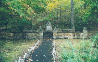
This memorial marks the site of the massacre of Captain William Phillips' Bedford County Militia on 16 July, 1780. It is located along the east side of Tussey Mountain in the Woodcock Valley in Bedford County.
Additional information about the Massacre of Phillips Rangers can be accessed by clicking on this icon:  |
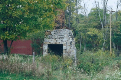
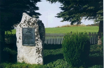
| All that remains of the fortified homestead of John Piper, Colonel of the Bedford County Militia, is this portion of fireplace and chimney. Colonel Piper fortified his homestead in order to provide protection against the Indians for his neighbors. |
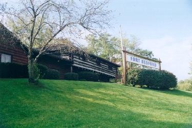
This photo shows the Fort Bedford Museum. It supposedly stands on the site of the original Fort Bedford. The museum was built as a representative of an early fort, but not necessarily to the specifications of the original Fort Bedford.
Additional information and photos of Fort Bedford can be accessed by clicking on this icon: |
Blair County
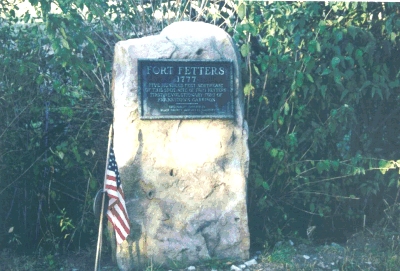
| This is a photo of a marker placed near the site of Fort Fetter in present-day Blair County. During the spring of 1999 a Comfort Inn motel was constructed on the actual site of the fort. Efforts had been made by the Blair County Chapter, SAR to obtain the cooperation of the Pennsylvania Bureau of Historical Preservation, Division of Archaeology and Protection to perform a site survey to determine if any artifacts or other evidence of the fort remained. The Bureau did not have the financial resources to devote to the project. |
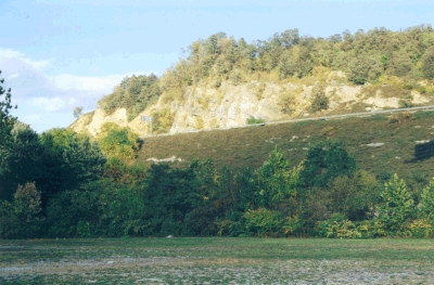
This is a view toward the site of the Engagement of Frankstown, which occurred on the 3rd of June, 1781. The Bedford and Cumberland County Militia under the command of Captain John Boyd were ambushed along the Beaverdam Run creek which flows at the base of this hill. The I-99 interstate highway, constructed along the face of the hill, can be seen in the top of this photo.
Additional information about the Engagement of Frankstown can be accessed by clicking on this icon: |
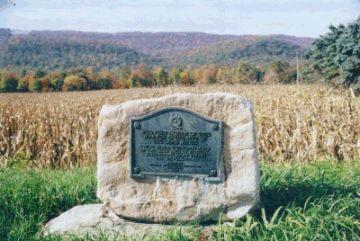
This bronze plaque marks the site of the the lead deposits which were mined during the 1777 through 1779 period in Sinking Spring Valley. The Fort Roberdeau had been constructed primarily to provide protection for the lead miners. Fort Roberdeau is located to the north of this site.
Additional information and photos of Fort Roberdeau can be accessed by clicking on this icon: |
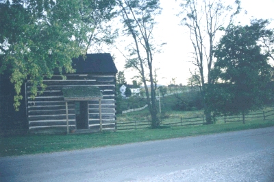
Captain William Phillips, whose company of Rangers was ambushed and massacred by Indians in the Woodcock Valley in 1780, fortified a structure, possibly a barn on his property for the protection of his family and neighbors. The log structure in the foreground of this photo was the Phillips homestead. The house in the background stands on the site of the fortified structure.
Additional information about the Massacre of the Phillips Rangers can be accessed by clicking on this icon: |
Fulton County
| This marker is located near the site of Fort Littleton, one of the supply points along the Forbes Road. The faint vertical line that appears in the distance is a flag pole which marks the actual site of the fortified structure. |
Huntingdon County
| This bronze plaque marks the site of McAlevy's Fort, a fortified structure built by Colonel William McAlevy in 1778. |
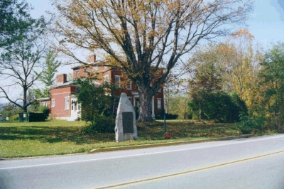
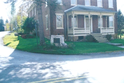
| Fort Shirley, one of the fortified structures built in the 1756-1758 period as a defensive position during the French and Indian War, was built on the site now occupied by the brick structure in this photo. George Croghan, the noted Indian trader and agent, commanded the garrison at Fort Shirley. The fort was used for defense by the local settlers during the American Revolutionary War. |